iMonsoon Climatology
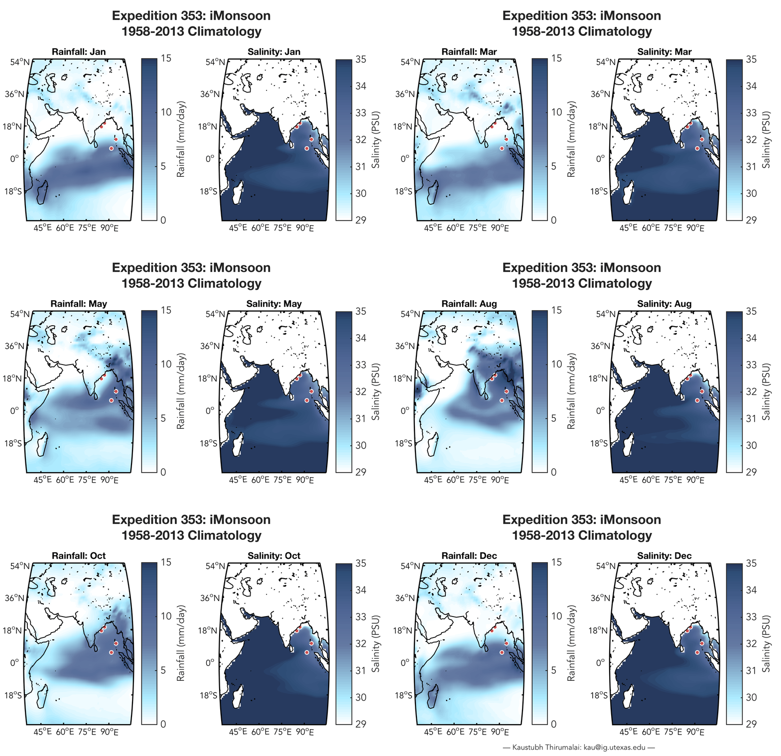
Here is a gif (click here for full version) of rainfall over the Indian subcontinent and concurrent sea-surface salinity (SSS) in the Indian Ocean with the targeted sites for Expedition 353 (red circles). The precipitation data are in mm of rainfall per day and the SSS data are displayed in practical salinity units. Each frame displays average monthly data for 55 years from 1958-2013 (i.e. averaging all January data, all February data etc.) There are many things of interest that pop out for me in this animation. Some points of note:
- The peak of monsoon rain over India is during the months of June, July, and August, or during Northern Hemisphere (boreal) summer.
- There is a well formed band of rainfall over the southern Indian Ocean during boreal winter.
- A freshwater pulse (< 30 PSU) close to the eastern coast of India can be observed a month or two after the JJA monsoon peak.
- During the monsoon, the Bay of Bengal (along with the subcontinent) experiences abundant rainfall.
- The Arabian Sea is much saltier than the Bay of Bengal.
- All of the targeted expedition sites display heterogeneity in their seasonality.
- Many Indian Ocean islands fall prey to poor coastal resolution data (oops!)
What pops out for you? Drop a line in the comments if you'd like details about the methodology.

